 Oklahoma Senate
The Santa Fe Trail
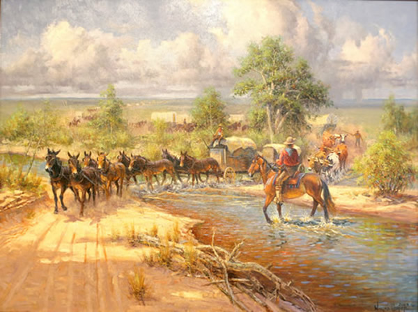
Artist: Wayne Cooper
Sponsor: Mrs. Mollie Williford
Dedication: April 12, 2005
Size: 30" x 40"
Type: Oil on Canvas
Location: 4th Floor Outside Senate Lounge
The Santa Fe Trail is thought to be the oldest and longest commercial highway across the Great Plains, from the Missouri River east of present day Kansas City crossing nearly 800 miles southwest on its way to Santa Fe, New Mexico. A direct path across the plains (the Cimarron Route or Cimarron Cut-Off) was used almost exclusively.
The Cimarron Route began from one of the many crossings of the Arkansas River between the lower bend and Choteau’s Island. It ran southwest across Kansas, the corner of southeastern Colorado, and into Cimarron County of the Oklahoma panhandle near the northeast corner. Crossing the Cimarron River, it angled in a southwesterly direction across the county and passed near Wolf Mountain, Flag Springs, Cold Springs, and Camp Nichols. The trail left the county near the southwest corner, closer to McNees Crossing in Union County, New Mexico.
The Cimarron Route was the road to Santa Fe for wagon traffic from 1822. It was shorter and easier to travel with mule and ox drawn freight wagons. The trail was used into the 1870’s when the railroad was built into Colorado.
One of the earliest travelers on the Trail through this area is believed to be the Spanish explorer, Don Francisco Vazquez de Coronado, around 1541. Others known to have followed portions of the Santa Fe Trail included numerous scouts, soldiers, trappers and buffalo hunters.
The Trail also served as a trading route of the Kiowa, Ute, Comanche and Apache tribes. Along the Trail, Autograph Rock has evidence left in writings on sandstone cliffs made by campers who chose that location to rest their wagon trains.
Images are copyright of The Oklahoma State Senate Historical Preservation Fund, Inc. and the artist. Please contact Matt Duehning at 405-524-0126 or Matt.Duehning@oksenate.gov for further copyright information.

